 Search
East Rock Park
New Haven, one of the first European-settled planned cities in North America, has always had municipal public spaces like New Haven Green. As the city’s population and industries exploded in the 1800s, however, there was a growing interest in providing more green spaces for public recreation and health. Prominent New Haven citizens, like their peers in many other American cities, started to make plans for large urban parks.
One site they selected was East Rock. People had long climbed to the top of the East Rock cliffs to admire the expansive view of New Haven and its surroundings. The hill was picturesque and did not have many buildings on it because its rough terrain made it bad for construction and farming. Additionally, the interest in quarrying the ridge’s stone had decreased as the century went on. East Rock ready for its new use.
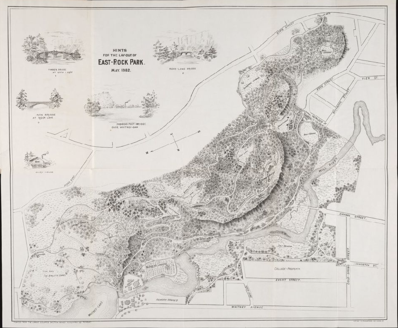
Yale President Noah Porter proposed a park at East Rock in 1877. New Haven Council appropriated funds for the park in 1879 and the East Rock Park Commission was chartered to create the park in 1880. Plans for a park were drawn up by local author and amateur landscape designer Donald Grant Mitchell (1822-1908). In 1884 the city purchased the summit and began reshaping the property into the park we know today.
One of the early supporters of East Rock Park was Henry Taylor Blake, son of Eli Whitney Blake and first cousin once removed of Eli Whitney Jr. Blake served on the New Haven Commission on Public Parks between 1889 and 1911. Blake Field in the park is named for him.
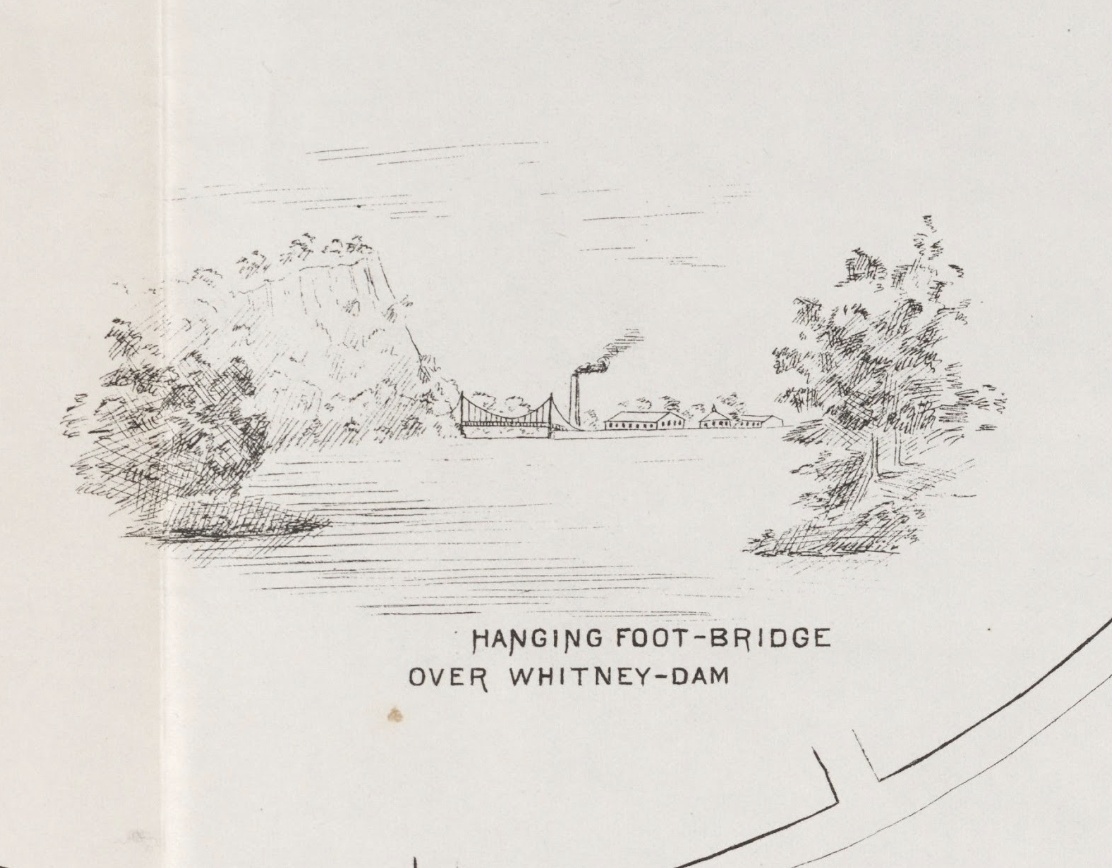
Eli Whitney Jr. also supported the effort, selling some of his land to be added to the future park. In his original plan, Donald Grant Mitchell proposed building a suspension footbridge above the Lake Whitney Dam. This would have given direct access from Whitneyville to the park, without having to go south to get around the Armory property. The bridge was never built, and direct access between Whitneyville and the park was only achieved when the Eli Whitney Museum and Workshop took over the Armory property in 1979.
Edgerton Park
In the nineteenth century, the area around the Whitney Armory was the outermost edge of New Haven. Wealthy families built small estates beyond the hustle and bustle of the city center. One of those estates was the home of Eli Whitney, Jr., which a 1858 map shows as a stylish 1850s country villa on the block formed by Whitney Avenue, Cliff Street, Prospect Street, and Highland Street.
It is a common misconception that Whitney Jr.’s home was Ivy Nook, where Caroline Crane, later Baldwin, née Whitney (1823-1905), lived until her death. Many sources state that Caroline Whitney was a niece of Eli Whitney, Sr. However, the two Whitneys were from unrelated families, and their status as neighbors seems to be a coincidence. Caroline and her second husband, Dr John Jacob Crane (1820-1890), moved to New Haven from New York and built Ivy Nook around 1875. Caroline later married Nathan Adolphus Baldwin (1824-1898).
After Caroline Whitney Baldwin’s death, New Haven financier Frederick F. Brewster (1872-1958) bought the Ivy Nook property. He tore down the Ivy Nook and replaced it with a more modern, grander home he named Edgerton - a pun, because the estate was on the edge of town. Frederick Brewster’s wife Margaret (née Fitch) lived at the house until her death in 1963. Afterwards, the Edgerton mansion was also torn down and the property was sold to the City of New Haven, which developed the estate into a city park.
In 2005, the South Central Connecticut Regional Water Authority (RWA) also developed the land around their purification plant next door to Edgerton Park into publicly accessible parkland.